Geolocate

Mavromati topographic map

Click on the map to display elevation.

About this map

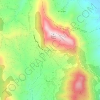
Name: Mavromati topographic map, elevation, terrain.

Location: Mavromati, Municipality of Messini, Messenia Regional Unit, Peloponnese Region, Peloponnese, Western Greece and the Ionian, 240 02, Greece (37.15933 21.90334 37.19933 21.94334)

Average elevation: 1,227 ft

Minimum elevation: 210 ft

Maximum elevation: 2,592 ft

Other topographic maps

Click on a map to view its topography, its elevation and its terrain.

Gear up for your next adventure:

🪶Fire Starter Kit - Reliable fire starter for survival and camping
🪄Magnetic Compass - Accurate compass for navigation
🔥Camping Stove - Portable stove for camping and backcountry cooking
🪓Survival Multi‑Tool - Versatile tool for camp and trail tasks
🧭Map Reading Tools - Tools and kits for map navigation

As an Amazon Associate, this site earns from qualifying purchases at no extra cost to you.