
Grüfflingen topographic map
Interactive map
Click on the map to display elevation.
About this map
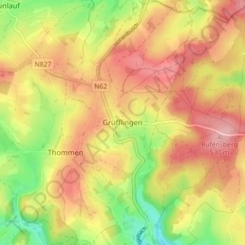
Name: Grüfflingen topographic map, elevation, terrain.
Location: Grüfflingen, Verviers, Liège, Wallonia, 4791, Belgium (50.20402 6.06892 50.24402 6.10892)
Average elevation: 1,568 ft
Minimum elevation: 1,316 ft
Maximum elevation: 1,765 ft