
Flums topographic map
Interactive map
Click on the map to display elevation.
About this map
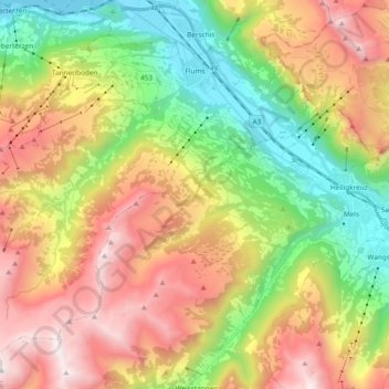
Name: Flums topographic map, elevation, terrain.
Location: Flums, Wahlkreis Sarganserland, Saint-Gall, Suisse (47.00043 9.21429 47.10574 9.40262)
Average elevation: 4,357 ft
Minimum elevation: 1,371 ft
Maximum elevation: 8,074 ft