
Make a donation
Gear up for your next adventure:
As an Amazon Associate, this site earns from qualifying purchases at no extra cost to you.
Jengish Chokusu topographic map
Click on the map to display elevation.
Make a donation
Gear up for your next adventure:
As an Amazon Associate, this site earns from qualifying purchases at no extra cost to you.
Jengish Chokusu
Jengish Chokusu or Victory Peak is the highest mountain in the Tian Shan mountain system in Central Asia at 7,439 metres (24,406 ft). It lies on the China–Kyrgyzstan border between the Ak-Suu District in the Issyk-Kul Region of far Eastern Kyrgyzstan and Wensu County, Xinjiang, China. It is part of the Kakshaal Too, the highest part of the Tian Shan, and is southeast of lake Issyk-Kul. Jengish Chokusu is the 16th most topographically prominent peak on Earth.
Make a donation
Gear up for your next adventure:
As an Amazon Associate, this site earns from qualifying purchases at no extra cost to you.
About this map
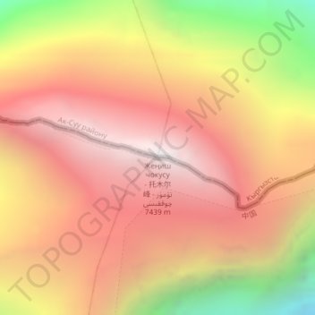
Name: Jengish Chokusu topographic map, elevation, terrain.
Location: Jengish Chokusu, Onsu County, Aksu Prefecture, Xinjiang, China (42.03461 80.12866 42.03471 80.12876)
Average elevation: 21,919 ft
Minimum elevation: 17,753 ft
Maximum elevation: 24,462 ft
Make a donation
Gear up for your next adventure:
As an Amazon Associate, this site earns from qualifying purchases at no extra cost to you.