
Hieflau topographic map
Interactive map
Click on the map to display elevation.
About this map
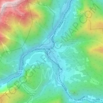
Name: Hieflau topographic map, elevation, terrain.
Location: Hieflau, Landl, Bezirk Liezen, Steiermark, 8931, Österreich (47.58694 14.72434 47.62694 14.76434)
Average elevation: 2,710 ft
Minimum elevation: 1,562 ft
Maximum elevation: 5,614 ft