
Thank you for supporting this site ❤️
Make a donation
Make a donation
Gear up for your next adventure:
As an Amazon Associate, this site earns from qualifying purchases at no extra cost to you.
Glasco topographic map
Click on the map to display elevation.
Thank you for supporting this site ❤️
Make a donation
Make a donation
Gear up for your next adventure:
As an Amazon Associate, this site earns from qualifying purchases at no extra cost to you.
About this map
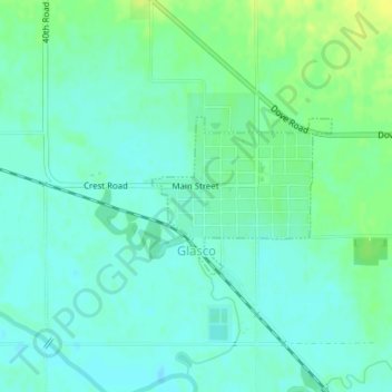
Name: Glasco topographic map, elevation, terrain.
Location: Glasco, Cloud County, Kansas, 67445, United States (39.35495 -97.84512 39.36587 -97.82911)
Average elevation: 1,329 ft
Minimum elevation: 1,306 ft
Maximum elevation: 1,368 ft
Cloud County trails, hiking, mountain biking, running and outdoor activities
Thank you for supporting this site ❤️
Make a donation
Make a donation
Gear up for your next adventure:
As an Amazon Associate, this site earns from qualifying purchases at no extra cost to you.