
Thank you for supporting this site ❤️
Make a donation
Make a donation
Gear up for your next adventure:
As an Amazon Associate, this site earns from qualifying purchases at no extra cost to you.
Nohfelden topographic map
Click on the map to display elevation.
Thank you for supporting this site ❤️
Make a donation
Make a donation
Gear up for your next adventure:
As an Amazon Associate, this site earns from qualifying purchases at no extra cost to you.
About this map
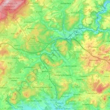
Name: Nohfelden topographic map, elevation, terrain.
Location: Nohfelden, Landkreis St. Wendel, Saarland, 66625, Germany (49.52205 6.99085 49.63943 7.21398)
Average elevation: 1,417 ft
Minimum elevation: 958 ft
Maximum elevation: 2,274 ft
Thank you for supporting this site ❤️
Make a donation
Make a donation
Gear up for your next adventure:
As an Amazon Associate, this site earns from qualifying purchases at no extra cost to you.