
Vista Hermosa topographic map
Interactive map
Click on the map to display elevation.
About this map
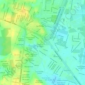
Name: Vista Hermosa topographic map, elevation, terrain.
Location: Vista Hermosa, Lázaro Cárdenas, Michoacán, México (17.99277 -102.22670 17.99554 -102.22301)
Average elevation: 56 ft
Minimum elevation: 20 ft
Maximum elevation: 102 ft
Other topographic maps
Click on a map to view its topography, its elevation and its terrain.
Lázaro Cárdenas
México > Michoacán > Lázaro Cárdenas
Lázaro Cárdenas, Michoacán, 60950, México
Average elevation: 138 ft
Acalpican de Morelos
México > Michoacán > Lázaro Cárdenas
Acalpican de Morelos, Lázaro Cárdenas, Michoacán, México
Average elevation: 135 ft
Condesa
México > Michoacán > Lázaro Cárdenas
Condesa, Lázaro Cárdenas, Michoacán, México
Average elevation: 62 ft