Geolocate
👉 Easily get elevation data in JSON, GeoTIFF and KML formats using Elevation API
Thank you for supporting this site ❤️
Make a donation

El Yunque topographic map

Click on the map to display elevation.

About this map

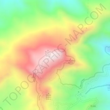
Name: El Yunque topographic map, elevation, terrain.

Location: El Yunque, Mameyes II, Río Grande, Puerto Rico, United States (18.31064 -65.79143 18.31074 -65.79133)

Average elevation: 2,513 ft

Minimum elevation: 1,637 ft

Maximum elevation: 3,383 ft

Río Grande trails, hiking, mountain biking, running and outdoor activities

Gear up for your next adventure:

🪶Camping Sleeping Pad - Comfortable sleeping pad for backpacking
🎒Day Hiking Backpack - Lightweight backpack perfect for day trips and outdoor adventures
🔥Fast-Boil Camping Stoves - Efficient cooking systems for quick trail meals
🎒Waterproof Dry Bags - Keep your electronics and maps dry inside your pack
📌Outdoor GPS Map App - Apps and devices for digital topographic navigation

As an Amazon Associate, this site earns from qualifying purchases at no extra cost to you.