
Gonceli topographic map
Interactive map
Click on the map to display elevation.
About this map
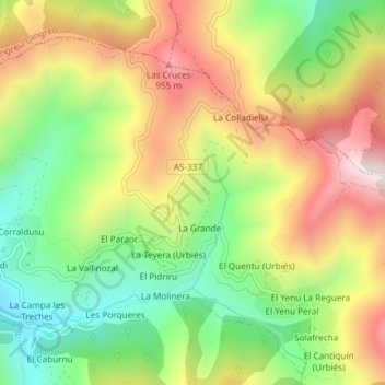
Name: Gonceli topographic map, elevation, terrain.
Location: Gonceli, Mieres, Asturies, 33988, Espagne (43.21005 -5.66298 43.23005 -5.64298)
Average elevation: 2,316 ft
Minimum elevation: 1,457 ft
Maximum elevation: 3,304 ft
Other topographic maps
Click on a map to view its topography, its elevation and its terrain.
El Vaḷḷitu / El Valletu
Espagne > Asturies > Mieres > Cuna
El Vaḷḷitu / El Valletu, Cuna, Mieres, Asturies, 33640, Espagne
Average elevation: 1,339 ft
Les cases d'Efrén
Espagne > Asturies > Mieres > Mieres > Les cases d'Efrén
Les cases d'Efrén, Mieres, Asturies, 33618, Espagne
Average elevation: 1,227 ft