Al-Tal topographic map
Interactive map
Click on the map to display elevation.
About this map
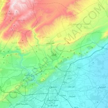
Name: Al-Tal topographic map, elevation, terrain.
Average elevation: 3,606 ft
Minimum elevation: 1,988 ft
Maximum elevation: 7,917 ft

Click on the map to display elevation.
Name: Al-Tal topographic map, elevation, terrain.
Average elevation: 3,606 ft
Minimum elevation: 1,988 ft
Maximum elevation: 7,917 ft