
Bantay Abot topographic map
Interactive map
Click on the map to display elevation.
About this map
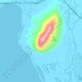
Name: Bantay Abot topographic map, elevation, terrain.
Average elevation: 82 ft
Minimum elevation: -3 ft
Maximum elevation: 840 ft
Other topographic maps
Click on a map to view its topography, its elevation and its terrain.
Barangay III
Philippines > Ilocos Sur > Vigan
Barangay III, Vigan, Ilocos Sur, Ilocos Region, 2700, Philippines
Average elevation: 30 ft
Ayusan Norte
Philippines > Ilocos Sur > Vigan
Ayusan Norte, Vigan, Ilocos Sur, Ilocos Region, 2700, Philippines
Average elevation: 26 ft
Barangay VII
Philippines > Ilocos Sur > Vigan > Barangay VII
Barangay VII, Vigan, Ilocos Sur, Ilocos Region, 2700, Philippines
Average elevation: 30 ft
Barangay II
Philippines > Ilocos Sur > Vigan > Barangay II
Barangay II, Vigan, Ilocos Sur, Ilocos Region, 2700, Philippines
Average elevation: 33 ft