
Le Kram topographic map
Interactive map
Click on the map to display elevation.
About this map
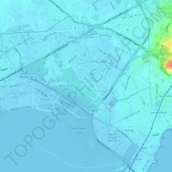
Name: Le Kram topographic map, elevation, terrain.
Location: Le Kram, Tunis, 2015, Tunisie (36.82862 10.26527 36.86720 10.32387)
Average elevation: 10 ft
Minimum elevation: -23 ft
Maximum elevation: 190 ft
Other topographic maps
Click on a map to view its topography, its elevation and its terrain.