
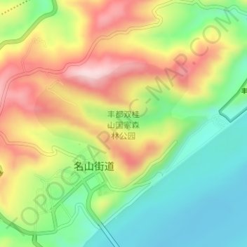
丰都双桂山国家森林公园 topographic map
Interactive map
Click on the map to display elevation.
About this map
Name: 丰都双桂山国家森林公园 topographic map, elevation, terrain.
Location: 丰都双桂山国家森林公园, 名山街道, 丰都县, 重庆市, 中国 (29.87829 107.69393 29.89243 107.71610)
Average elevation: 873 ft
Minimum elevation: 430 ft
Maximum elevation: 1,434 ft