
บ้านโนนเขวา topographic map
Interactive map
Click on the map to display elevation.
About this map
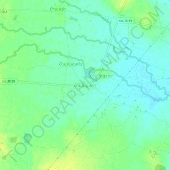
Name: บ้านโนนเขวา topographic map, elevation, terrain.
Location: บ้านโนนเขวา, พระยืน, Khon Kaen, Thaïlande (16.35951 102.64472 16.39951 102.68472)
Average elevation: 551 ft
Minimum elevation: 525 ft
Maximum elevation: 584 ft
Other topographic maps
Click on a map to view its topography, its elevation and its terrain.