
La Cantolla topographic map
Interactive map
Click on the map to display elevation.
About this map
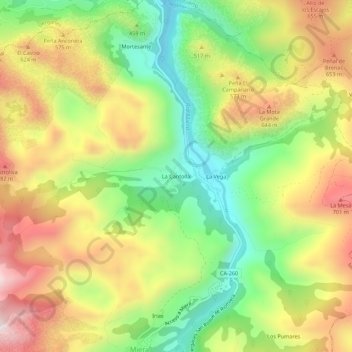
Name: La Cantolla topographic map, elevation, terrain.
Location: La Cantolla, Miera, Cantabria, 39723, España (43.27515 -3.72691 43.31515 -3.68691)
Average elevation: 1,512 ft
Minimum elevation: 456 ft
Maximum elevation: 2,703 ft
Other topographic maps
Click on a map to view its topography, its elevation and its terrain.