
Rainbow Ridge topographic map
Interactive map
Click on the map to display elevation.
About this map
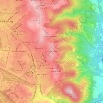
Name: Rainbow Ridge topographic map, elevation, terrain.
Location: Rainbow Ridge, Montgomery County, Virginia, 24063, USA (37.19791 -80.41144 37.23791 -80.37144)
Average elevation: 2,028 ft
Minimum elevation: 1,506 ft
Maximum elevation: 2,343 ft