
Lac Outardes topographic map
Interactive map
Click on the map to display elevation.
About this map
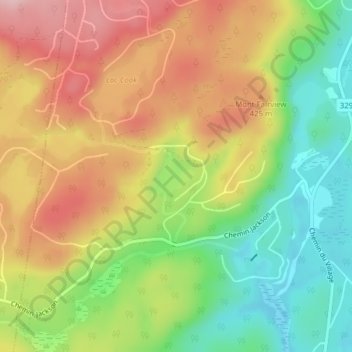
Name: Lac Outardes topographic map, elevation, terrain.
Average elevation: 1,217 ft
Minimum elevation: 879 ft
Maximum elevation: 1,572 ft
Other topographic maps
Click on a map to view its topography, its elevation and its terrain.
Lac Perry
Canada > Québec > Morin-Heights
Lac Perry, Rue Perry, Morin-Heights, Les Pays-d'en-Haut, Laurentides, Québec, J0R 1H0, Canada
Average elevation: 1,115 ft