
Bălțătești topographic map
Interactive map
Click on the map to display elevation.
About this map
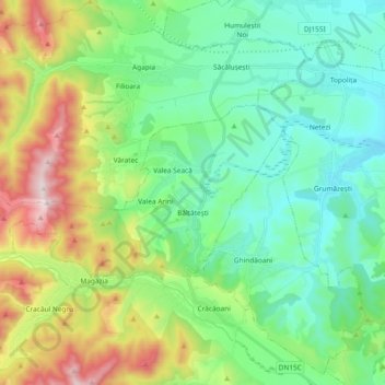
Name: Bălțătești topographic map, elevation, terrain.
Location: Bălțătești, Neamț, Romania (47.10327 26.16777 47.16096 26.35387)
Average elevation: 1,722 ft
Minimum elevation: 1,083 ft
Maximum elevation: 3,294 ft
Other topographic maps
Click on a map to view its topography, its elevation and its terrain.