
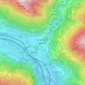
Pont-Saint-Martin topographic map
Interactive map
Click on the map to display elevation.
About this map
Name: Pont-Saint-Martin topographic map, elevation, terrain.
Location: Pont-Saint-Martin, Vallée d'Aoste, 11026, Italie (45.58639 7.78440 45.61137 7.84887)
Average elevation: 2,339 ft
Minimum elevation: 928 ft
Maximum elevation: 5,633 ft