
Río Arga topographic map
Interactive map
Click on the map to display elevation.
About this map
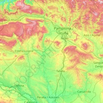
Name: Río Arga topographic map, elevation, terrain.
Location: Río Arga, Navarra, 31638, España (42.29607 -1.85829 43.03487 -1.46372)
Average elevation: 1,916 ft
Minimum elevation: 600 ft
Maximum elevation: 4,970 ft
Other topographic maps
Click on a map to view its topography, its elevation and its terrain.