
天平山村 topographic map
Interactive map
Click on the map to display elevation.
About this map
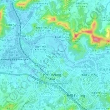
Name: 天平山村 topographic map, elevation, terrain.
Location: 天平山村, 上水圍, 北區, 新界, 香港, 518005, 中国 (22.48922 114.11006 22.52922 114.15006)
Average elevation: 72 ft
Minimum elevation: -7 ft
Maximum elevation: 469 ft