
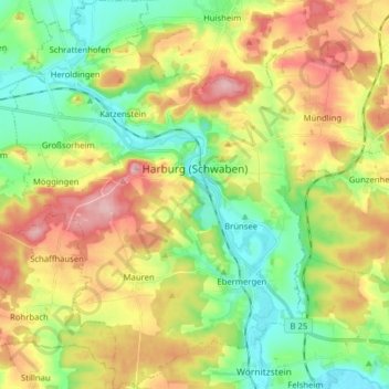
Harburg (Schwaben) topographic map
Interactive map
Click on the map to display elevation.
About this map
Name: Harburg (Schwaben) topographic map, elevation, terrain.
Average elevation: 1,552 ft
Minimum elevation: 1,309 ft
Maximum elevation: 1,893 ft
Other topographic maps
Click on a map to view its topography, its elevation and its terrain.
Wallerstein
Duitsland > Beieren > Landkreis Donau-Ries
Wallerstein, Wallerstein (VGem), Landkreis Donau-Ries, Beieren, 86757, Duitsland
Average elevation: 1,470 ft
Donauwörth
Duitsland > Beieren > Landkreis Donau-Ries
Donauwörth, Landkreis Donau-Ries, Beieren, 86609, Duitsland
Average elevation: 1,453 ft
Rain
Duitsland > Beieren > Landkreis Donau-Ries
Rain, Rain (Schwaben), Landkreis Donau-Ries, Beieren, 86641, Duitsland
Average elevation: 1,358 ft
Nördlingen
Duitsland > Beieren > Landkreis Donau-Ries
Nördlingen, Landkreis Donau-Ries, Beieren, Duitsland
Average elevation: 1,486 ft