
Catac topographic map
Interactive map
Click on the map to display elevation.
About this map
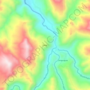
Name: Catac topographic map, elevation, terrain.
Location: Catac, San Miguel de Cauri, Lauricocha, Huánuco, Perú (-10.23233 -76.63246 -10.19233 -76.59246)
Average elevation: 12,618 ft
Minimum elevation: 11,844 ft
Maximum elevation: 13,622 ft
Other topographic maps
Click on a map to view its topography, its elevation and its terrain.
Río Lauricocha
Perú > Huánuco > San Miguel de Cauri
Río Lauricocha, San Miguel de Cauri, Lauricocha, Huánuco, Perú
Average elevation: 13,360 ft
Laguna Sacracocha
Perú > Huánuco > San Miguel de Cauri
Laguna Sacracocha, San Miguel de Cauri, Lauricocha, Huánuco, Perú
Average elevation: 13,924 ft
Laguna Lauricocha
Perú > Huánuco > San Miguel de Cauri
Laguna Lauricocha, HU-110, San Miguel de Cauri, Lauricocha, Huánuco, Perú
Average elevation: 13,619 ft