
Älvkarleby kommun topographic map
Interactive map
Click on the map to display elevation.
About this map
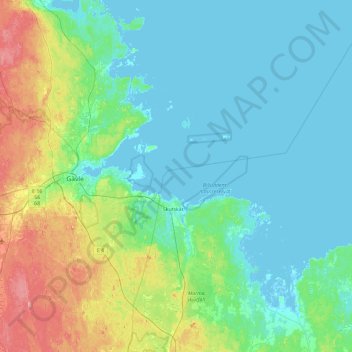
Name: Älvkarleby kommun topographic map, elevation, terrain.
Location: Älvkarleby kommun, Uppsala County, Sweden (60.44680 17.28783 60.90733 18.10073)
Average elevation: 66 ft
Minimum elevation: -10 ft
Maximum elevation: 331 ft
Other topographic maps
Click on a map to view its topography, its elevation and its terrain.
Uppsala
Uppsala, Uppsala kommun, Uppsala County, 753 20, Sweden
Average elevation: 95 ft
Älvkarleby kommun
Älvkarleby kommun, Uppsala County, Sweden
Average elevation: 72 ft