
Mount Nyangani topographic map
Interactive map
Click on the map to display elevation.
About this map
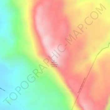
Name: Mount Nyangani topographic map, elevation, terrain.
Location: Mount Nyangani, Nyanga, Manicaland, Zimbabwe (-18.29999 32.84208 -18.29989 32.84218)
Average elevation: 7,641 ft
Minimum elevation: 6,624 ft
Maximum elevation: 8,474 ft
Other topographic maps
Click on a map to view its topography, its elevation and its terrain.