尻別川 topographic map
Interactive map
Click on the map to display elevation.
About this map
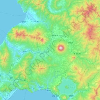
Name: 尻別川 topographic map, elevation, terrain.
Average elevation: 1,142 ft
Minimum elevation: -7 ft
Maximum elevation: 6,135 ft

Click on the map to display elevation.
Name: 尻別川 topographic map, elevation, terrain.
Average elevation: 1,142 ft
Minimum elevation: -7 ft
Maximum elevation: 6,135 ft