
Miraflor topographic map
Interactive map
Click on the map to display elevation.
About this map
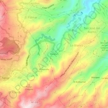
Name: Miraflor topographic map, elevation, terrain.
Location: Miraflor, Teror, Las Palmas, Canarias, 35330, España (28.04792 -15.54727 28.08792 -15.50727)
Average elevation: 1,811 ft
Minimum elevation: 837 ft
Maximum elevation: 2,703 ft
Other topographic maps
Click on a map to view its topography, its elevation and its terrain.
Sagrado Corazón
Sagrado Corazón, Teror, Las Palmas, Canarias, 35338, España
Average elevation: 2,740 ft