Geolocate

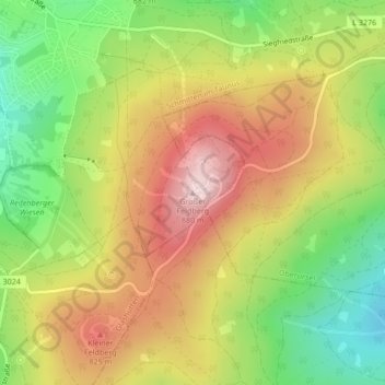
Großer Feldberg topographic map

Click on the map to display elevation.

Großer Feldberg

The Großer Feldberg ('Great Field Mountain') is, at a height of 879.5 metres, the highest elevation of the Taunus mountains, and of the entire Rhenish Massif. It is situated in the Hochtaunuskreis district in Hesse, Germany.

Wikipedia (CC-BY-SA 3.0)

About this map

Name: Großer Feldberg topographic map, elevation, terrain.

Location: Großer Feldberg, Schmitten im Taunus, Hochtaunuskreis, Hesse, 61389, Germany (50.23177 8.45678 50.23187 8.45688)

Average elevation: 2,349 ft

Minimum elevation: 1,801 ft

Maximum elevation: 2,900 ft

Gear up for your next adventure:

🧯Emergency Survival Kit - All‑in‑one survival essentials for the backcountry
🔊Portable Camp Speaker - Music and alerts at camp
🪶Multi‑Purpose Knife - Useful blade for camp and trail
🔥Plasma Lighters - Windproof lighters that work in any weather condition
🦶Carbon Trekking Poles - Reduce knee impact on steep descents with ultra-light poles

As an Amazon Associate, this site earns from qualifying purchases at no extra cost to you.