
Hoopeston topographic map
Click on the map to display elevation.
About this map
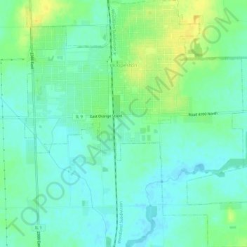
Name: Hoopeston topographic map, elevation, terrain.
Location: Hoopeston, Vermilion County, Illinois, 60942, United States (40.43792 -87.68935 40.47767 -87.64031)
Average elevation: 715 ft
Minimum elevation: 689 ft
Maximum elevation: 761 ft
Vermilion County trails, hiking, mountain biking, running and outdoor activities
Other topographic maps
Click on a map to view its topography, its elevation and its terrain.
Middle Fork State Fish and Wildlife Area
United States > Illinois > Vermilion County
Average elevation: 676 ft