Geolocate

Nogal topographic map

Click on the map to display elevation.

About this map

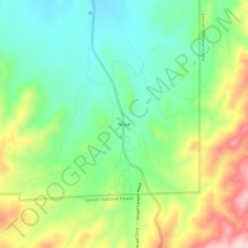
Name: Nogal topographic map, elevation, terrain.

Location: Nogal, Lincoln County, New Mexico, United States (33.53813 -105.72776 33.57813 -105.68776)

Average elevation: 6,614 ft

Minimum elevation: 6,280 ft

Maximum elevation: 7,188 ft

Lincoln County trails, hiking, mountain biking, running and outdoor activities

Gear up for your next adventure:

🔌Solar Panel Charger - Charge gear sustainably outdoors
🪄Magnetic Compass - Accurate compass for navigation
📚USA Hiking Guide Books - Top trail guides and map books
🛶Inflatable Kayak - Portable kayak for rivers, lakes, and expeditions
🧭Outdoor Navigation Book - Learn advanced navigation skills

As an Amazon Associate, this site earns from qualifying purchases at no extra cost to you.