
Thank you for supporting this site ❤️
Make a donation
Make a donation
Gear up for your next adventure:
As an Amazon Associate, this site earns from qualifying purchases at no extra cost to you.
Gahunje topographic map
Click on the map to display elevation.
Thank you for supporting this site ❤️
Make a donation
Make a donation
Gear up for your next adventure:
As an Amazon Associate, this site earns from qualifying purchases at no extra cost to you.
About this map
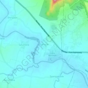
Name: Gahunje topographic map, elevation, terrain.
Location: Gahunje, Mawal, Pune District, Maharashtra, 412101, India (18.64682 73.68208 18.68682 73.72208)
Average elevation: 1,916 ft
Minimum elevation: 1,850 ft
Maximum elevation: 2,379 ft
Thank you for supporting this site ❤️
Make a donation
Make a donation
Gear up for your next adventure:
As an Amazon Associate, this site earns from qualifying purchases at no extra cost to you.