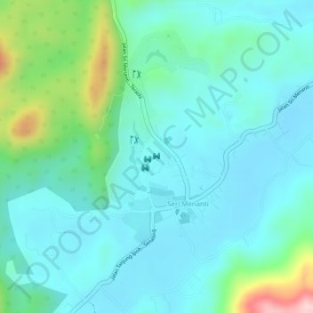
Istana Seri Menanti topographic map
Interactive map
Click on the map to display elevation.
About this map
Name: Istana Seri Menanti topographic map, elevation, terrain.
Average elevation: 505 ft
Minimum elevation: 322 ft
Maximum elevation: 1,138 ft

Click on the map to display elevation.
Name: Istana Seri Menanti topographic map, elevation, terrain.
Average elevation: 505 ft
Minimum elevation: 322 ft
Maximum elevation: 1,138 ft