
Ballasalla topographic map
Interactive map
Click on the map to display elevation.
About this map
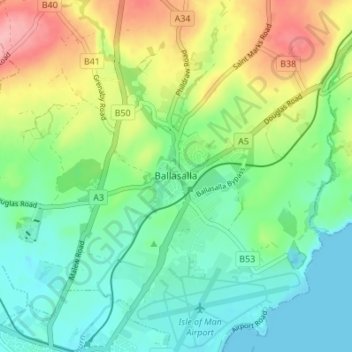
Name: Ballasalla topographic map, elevation, terrain.
Location: Ballasalla, Malew, Rushen, Isle of Man (54.07778 -4.65162 54.11778 -4.61162)
Average elevation: 128 ft
Minimum elevation: -3 ft
Maximum elevation: 381 ft