
Aïn Zitoun topographic map
Interactive map
Click on the map to display elevation.
About this map
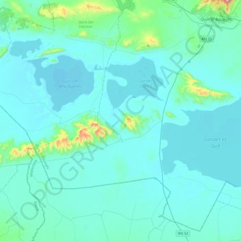
Name: Aïn Zitoun topographic map, elevation, terrain.
Location: Aïn Zitoun, Daïra Oum El Bouaghi, Oum El Bouaghi, 04023, Algérie (35.54525 6.77427 35.88299 7.22684)
Average elevation: 2,874 ft
Minimum elevation: 2,700 ft
Maximum elevation: 4,839 ft
Other topographic maps
Click on a map to view its topography, its elevation and its terrain.
Oum El Bouaghi
Algérie > Oum El Bouaghi > Daïra Oum El Bouaghi
Oum El Bouaghi, Daïra Oum El Bouaghi, Oum El Bouaghi, 04000, Algérie
Average elevation: 2,976 ft
Daïra Oum El Bouaghi
Algérie > Oum El Bouaghi > Daïra Oum El Bouaghi
Daïra Oum El Bouaghi, Oum El Bouaghi, Algérie
Average elevation: 2,913 ft