
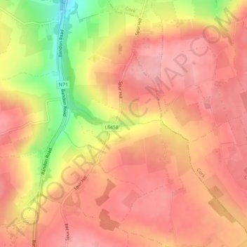
Knockalisheen topographic map
Interactive map
Click on the map to display elevation.
About this map
Name: Knockalisheen topographic map, elevation, terrain.
Average elevation: 400 ft
Minimum elevation: 141 ft
Maximum elevation: 509 ft
Other topographic maps
Click on a map to view its topography, its elevation and its terrain.
Monkstown
Ireland > County Cork > Municipal District of Carrigaline
Monkstown, Municipal District of Carrigaline, County Cork, Munster, T12 KT5N, Ireland
Average elevation: 144 ft
Ballinvarosig
Ireland > County Cork > Municipal District of Carrigaline
Ballinvarosig, Kilpatrick, Municipal District of Carrigaline, County Cork, Munster, Ireland
Average elevation: 335 ft
Ballyburden More
Ireland > County Cork > Municipal District of Carrigaline
Ballyburden More, Ballincollig ED, Municipal District of Carrigaline, County Cork, Munster, Ireland
Average elevation: 249 ft
Kilnaglory
Ireland > County Cork > Municipal District of Carrigaline
Kilnaglory, Ballincollig ED, Municipal District of Carrigaline, County Cork, Munster, Ireland
Average elevation: 177 ft
Kilmoney
Ireland > County Cork > Municipal District of Carrigaline
Kilmoney, Liscleary, Municipal District of Carrigaline, County Cork, Munster, Ireland
Average elevation: 246 ft
Minane Bridge
Ireland > County Cork > Municipal District of Carrigaline
Minane Bridge, Municipal District of Carrigaline, County Cork, Munster, P17 K725, Ireland
Average elevation: 230 ft