Geolocate

New Waverly topographic map

Click on the map to display elevation.

About this map

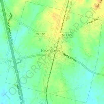
Name: New Waverly topographic map, elevation, terrain.

Location: New Waverly, Walker County, Texas, United States (30.52419 -95.49734 30.55049 -95.46686)

Average elevation: 341 ft

Minimum elevation: 299 ft

Maximum elevation: 387 ft

Walker County trails, hiking, mountain biking, running and outdoor activities

Other topographic maps

Click on a map to view its topography, its elevation and its terrain.

Dodge

United States > Texas > Walker County

Average elevation: 377 ft

Pine Hill

United States > Texas > Walker County > Huntsville

Average elevation: 404 ft

Gear up for your next adventure:

🪶Trail Camera - Capture wildlife on your hikes
🏕️Family Camping Gear - Essentials for group camping trips
🪶Thermal Camp Blanket - Extra warmth for cold nights
🗺️NatGeo Topo Maps - High-quality waterproof printed topographic maps of US Parks
📦Dry Bags Set - Waterproof storage for electronics and clothes

As an Amazon Associate, this site earns from qualifying purchases at no extra cost to you.