
Thank you for supporting this site ❤️
Make a donation
Make a donation
Gear up for your next adventure:
As an Amazon Associate, this site earns from qualifying purchases at no extra cost to you.
Pambabuela topographic map
Click on the map to display elevation.
Thank you for supporting this site ❤️
Make a donation
Make a donation
Gear up for your next adventure:
As an Amazon Associate, this site earns from qualifying purchases at no extra cost to you.
About this map
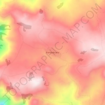
Name: Pambabuela topographic map, elevation, terrain.
Location: Pambabuela, Salinas, Guaranda, Bolívar, 020107, Ecuador (-1.40364 -79.06221 -1.36364 -79.02221)
Average elevation: 12,024 ft
Minimum elevation: 10,463 ft
Maximum elevation: 12,559 ft
Thank you for supporting this site ❤️
Make a donation
Make a donation
Gear up for your next adventure:
As an Amazon Associate, this site earns from qualifying purchases at no extra cost to you.