Geolocate

Rurrenabaque topographic map

Click on the map to display elevation.

About this map
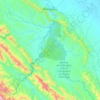
Name: Rurrenabaque topographic map, elevation, terrain.

Location: Rurrenabaque, General José Ballivián Segurola, Beni, Bolivia (-15.19438 -67.56135 -14.36898 -67.05995)

Average elevation: 1,512 ft

Minimum elevation: 528 ft

Maximum elevation: 7,631 ft

Other topographic maps

Click on a map to view its topography, its elevation and its terrain.

Gear up for your next adventure:

🥤Water Filter Bottle - All‑in‑one filter bottle for safe hydration
🦟Ultrasonic Repellers - Create a bug-free zone at your camp or rest stop
🔥Plasma Lighters - Windproof lighters that work in any weather condition
🏫Relief Map Kits - Hands-on tools for teaching landforms and elevation
🧭Hiking Compass - Precision compass for reliable navigation in the wilderness

As an Amazon Associate, this site earns from qualifying purchases at no extra cost to you.