
Riudecols topographic map
Interactive map
Click on the map to display elevation.
About this map
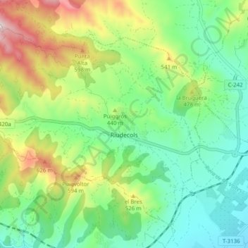
Name: Riudecols topographic map, elevation, terrain.
Location: Riudecols, Bajo Campo, Tarragona, Cataluña, 43390, España (41.14711 0.92184 41.19401 0.99815)
Average elevation: 1,243 ft
Minimum elevation: 594 ft
Maximum elevation: 2,569 ft