
El Nith topographic map
Interactive map
Click on the map to display elevation.
About this map
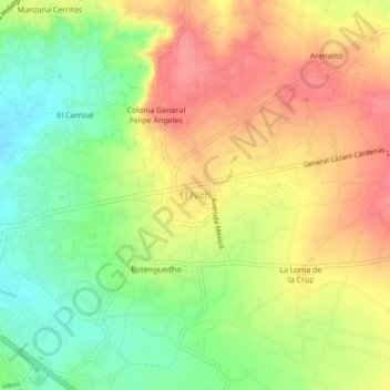
Name: El Nith topographic map, elevation, terrain.
Location: El Nith, Ixmiquilpan, Hidalgo, 42325, México (20.46980 -99.21102 20.50980 -99.17102)
Average elevation: 5,692 ft
Minimum elevation: 5,551 ft
Maximum elevation: 5,823 ft
Other topographic maps
Click on a map to view its topography, its elevation and its terrain.
Panales
México > Hidalgo > Ixmiquilpan
Panales, Ixmiquilpan, Hidalgo, México
Average elevation: 5,814 ft
El Dexthi
México > Hidalgo > Ixmiquilpan
El Dexthi, Ixmiquilpan, Hidalgo, México
Average elevation: 6,033 ft