
Thank you for supporting this site ❤️
Make a donation
Make a donation
Gear up for your next adventure:
As an Amazon Associate, this site earns from qualifying purchases at no extra cost to you.
Mkushi topographic map
Click on the map to display elevation.
Thank you for supporting this site ❤️
Make a donation
Make a donation
Gear up for your next adventure:
As an Amazon Associate, this site earns from qualifying purchases at no extra cost to you.
About this map
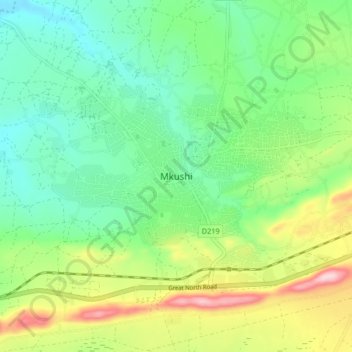
Name: Mkushi topographic map, elevation, terrain.
Location: Mkushi, Mkushi District, Central Province, Zambia (-13.65886 29.35123 -13.57886 29.43123)
Average elevation: 4,203 ft
Minimum elevation: 3,927 ft
Maximum elevation: 4,770 ft
Thank you for supporting this site ❤️
Make a donation
Make a donation
Gear up for your next adventure:
As an Amazon Associate, this site earns from qualifying purchases at no extra cost to you.