
Make a donation
Gear up for your next adventure:
As an Amazon Associate, this site earns from qualifying purchases at no extra cost to you.
Sidoagung topographic map
Click on the map to display elevation.
Make a donation
Gear up for your next adventure:
As an Amazon Associate, this site earns from qualifying purchases at no extra cost to you.
About this map
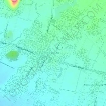
Name: Sidoagung topographic map, elevation, terrain.
Average elevation: 394 ft
Minimum elevation: 322 ft
Maximum elevation: 663 ft
Make a donation
Gear up for your next adventure:
As an Amazon Associate, this site earns from qualifying purchases at no extra cost to you.
Other topographic maps
Click on a map to view its topography, its elevation and its terrain.
Petung
Indonesia > Special Region of Yogyakarta > Sleman Regency > Cangkringan
Average elevation: 2,835 ft
Sidorejo
Indonesia > Special Region of Yogyakarta > Sleman Regency > Cangkringan
Average elevation: 2,867 ft
Waterboom Jogja
Indonesia > Special Region of Yogyakarta > Sleman Regency > Wedomartani
Average elevation: 577 ft
Sidorejo
Indonesia > Special Region of Yogyakarta > Sleman Regency > Cangkringan
Average elevation: 2,867 ft
Make a donation
Gear up for your next adventure:
As an Amazon Associate, this site earns from qualifying purchases at no extra cost to you.
Kopeng Kepuhharjo
Indonesia > Special Region of Yogyakarta > Sleman Regency > Kepuhharjo
Average elevation: 2,477 ft
Make a donation
Gear up for your next adventure:
As an Amazon Associate, this site earns from qualifying purchases at no extra cost to you.
Sendang Tirto
Indonesia > Special Region of Yogyakarta > Sleman Regency > Sendangtirto
Average elevation: 302 ft
Candi Binangun
Indonesia > Special Region of Yogyakarta > Sleman Regency > Candibinangun
Average elevation: 1,486 ft
Gunung Merapi
Indonesia > Special Region of Yogyakarta > Sleman Regency > Hargobinangun
Average elevation: 7,411 ft
Janti
Indonesia > Special Region of Yogyakarta > Sleman Regency > Catur tunggal
Average elevation: 407 ft
Make a donation
Gear up for your next adventure:
As an Amazon Associate, this site earns from qualifying purchases at no extra cost to you.
Cepetsari Glagahharjo
Indonesia > Special Region of Yogyakarta > Sleman Regency > Glagah Harjo
Average elevation: 1,640 ft
Karangmalang
Indonesia > Special Region of Yogyakarta > Sleman Regency > Catur tunggal
Average elevation: 456 ft
Ijo Temple
Indonesia > Special Region of Yogyakarta > Sleman Regency > Sambirejo
The temple compound is located in Groyokan hamlet, Sambirejo village, Kecamatan Prambanan, Sleman Regency, Yogyakarta. The temple's name derived from its location, the Gumuk Ijo hill. The temple compound stood on western slope of the hill, in a quiet region east of Yogyakarta, around 4 kilometers southeast…
Average elevation: 764 ft
Kayen
Indonesia > Special Region of Yogyakarta > Sleman Regency > Condongcatur
Average elevation: 597 ft
Make a donation
Gear up for your next adventure:
As an Amazon Associate, this site earns from qualifying purchases at no extra cost to you.
Sleman
Indonesia > Special Region of Yogyakarta > Sleman Regency > Triharjo
Average elevation: 1,122 ft
Ngipiksari
Indonesia > Special Region of Yogyakarta > Sleman Regency > Hargobinangun
Average elevation: 2,605 ft
Sawungan
Indonesia > Special Region of Yogyakarta > Sleman Regency > Hargobinangun
Average elevation: 1,811 ft
Make a donation
Gear up for your next adventure:
As an Amazon Associate, this site earns from qualifying purchases at no extra cost to you.
Wisdom park
Indonesia > Special Region of Yogyakarta > Sleman Regency > Catur tunggal
Average elevation: 446 ft
Kaliurang
Indonesia > Special Region of Yogyakarta > Sleman Regency > Hargobinangun
Average elevation: 2,815 ft
Condong Catur
Indonesia > Special Region of Yogyakarta > Sleman Regency > Condongcatur > Condong Catur
Average elevation: 535 ft
Embung Tambakboyo
Indonesia > Special Region of Yogyakarta > Sleman Regency > Condongcatur > Condongcatur
Average elevation: 538 ft
Make a donation
Gear up for your next adventure:
As an Amazon Associate, this site earns from qualifying purchases at no extra cost to you.