
Mangrullo topographic map
Interactive map
Click on the map to display elevation.
About this map
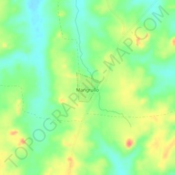
Name: Mangrullo topographic map, elevation, terrain.
Location: Mangrullo, Cerro Largo, 37000, Uruguay (-32.09269 -54.04871 -32.08813 -54.04432)
Average elevation: 499 ft
Minimum elevation: 423 ft
Maximum elevation: 594 ft
Other topographic maps
Click on a map to view its topography, its elevation and its terrain.
Isidoro Noblía
Uruguay > Cerro Largo > Isidoro Noblía
Isidoro Noblía, Cerro Largo, 37002, Uruguay
Average elevation: 436 ft