
Collada Chamixé topographic map
Interactive map
Click on the map to display elevation.
About this map
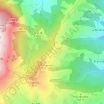
Name: Collada Chamixé topographic map, elevation, terrain.
Location: Collada Chamixé, Lena, Asturië, 33639, Spanje (43.17391 -5.87792 43.17401 -5.87782)
Average elevation: 2,933 ft
Minimum elevation: 1,650 ft
Maximum elevation: 4,688 ft