
Cime de Colle Longue topographic map
Interactive map
Click on the map to display elevation.
About this map
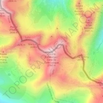
Name: Cime de Colle Longue topographic map, elevation, terrain.
Location: Cime de Colle Longue, Vinadio, Coni, Piémont, Italie (44.23231 7.01924 44.23241 7.01934)
Average elevation: 8,074 ft
Minimum elevation: 6,854 ft
Maximum elevation: 9,078 ft
Other topographic maps
Click on a map to view its topography, its elevation and its terrain.
San Bernolfo
Italie > Piémont > Coni > Vinadio
San Bernolfo, Vinadio, Coni, Piémont, Italie
Average elevation: 6,680 ft
Dahu de Sabarnui
Italie > Piémont > Coni > Vinadio > San Bernolfo
Dahu de Sabarnui, 17, San Bernolfo, Vinadio, Coni, Piémont, Italie
Average elevation: 6,299 ft
Col de la Lombarde
Italie > Piémont > Coni > Vinadio
Col de la Lombarde, Vinadio, Coni, Piémont, Italie
Average elevation: 7,497 ft