
River Loughor topographic map
Interactive map
Click on the map to display elevation.
About this map
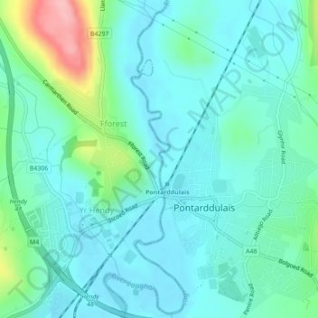
Name: River Loughor topographic map, elevation, terrain.
Location: River Loughor, Swansea, Wales, SA4 8TL, United Kingdom (51.71215 -4.05040 51.72613 -4.04512)
Average elevation: 105 ft
Minimum elevation: 7 ft
Maximum elevation: 476 ft
Other topographic maps
Click on a map to view its topography, its elevation and its terrain.
River Tawe
United Kingdom > Wales > Swansea
River Tawe, Swansea, Wales, SA1 8PH, United Kingdom
Average elevation: 39 ft
Landore
United Kingdom > Wales > Swansea
Landore, Swansea, Wales, United Kingdom
Average elevation: 230 ft
Clyne River
United Kingdom > Wales > Swansea
Clyne River, Swansea, Wales, SA3 5AT, United Kingdom
Average elevation: 82 ft