
Masbourg topographic map
Interactive map
Click on the map to display elevation.
About this map
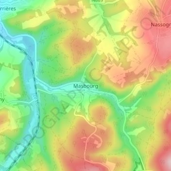
Name: Masbourg topographic map, elevation, terrain.
Location: Masbourg, Luxembourg, Wallonie, 6953, Belgique (50.09435 5.29369 50.13435 5.33369)
Average elevation: 1,010 ft
Minimum elevation: 669 ft
Maximum elevation: 1,437 ft