Geolocate

Short Pump topographic map

Click on the map to display elevation.

About this map

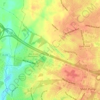
Name: Short Pump topographic map, elevation, terrain.

Location: Short Pump, Henrico County, Virginia, 23233, United States (37.62998 -77.65445 37.68935 -77.58162)

Average elevation: 243 ft

Minimum elevation: 121 ft

Maximum elevation: 318 ft

Henrico County trails, hiking, mountain biking, running and outdoor activities

Gear up for your next adventure:

🧦Merino Wool Socks - Moisture-wicking, blister-preventing socks for long treks
🎒Hydration Pack - Hands‑free water reservoir for long hikes
📦Dry Bags Set - Waterproof storage for electronics and clothes
📚USA Hiking Guide Books - Top trail guides and map books
🦺Reflective Outdoor Gear - Safety gear for low‑light conditions

As an Amazon Associate, this site earns from qualifying purchases at no extra cost to you.