
Budleigh Salterton topographic map
Interactive map
Click on the map to display elevation.
About this map
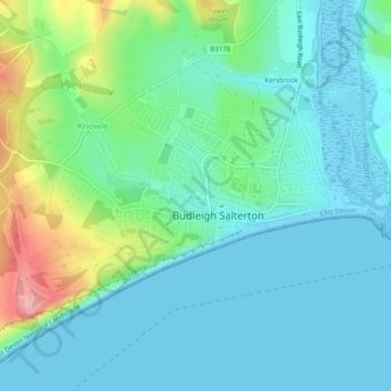
Name: Budleigh Salterton topographic map, elevation, terrain.
Location: Budleigh Salterton, East Devon, Devon, England, United Kingdom (50.62009 -3.35347 50.64209 -3.30548)
Average elevation: 95 ft
Minimum elevation: -10 ft
Maximum elevation: 420 ft